I've been trying to write up some of the better rides I do, and this one is about a ride south of town just outside of Lolo. Lolo Peak is the north end of the Bitterroot mountain range and I want to say it's just shy of 10k feet tall, which isn't the biggest one down there, but with the valley floor at 3300 or so they all stick up quite a bit, and lolo peak has a whole bunch of mass.
Much of the bitterroot is in wilderness, including the top of lolo peak, so there isn't a ton of mountain biking, but the north/east side of the mountain isn't and there are a couple of pretty good trails.
The other nice thing is that a road goes a good way up to the lolo peak trailhead, so you can shuttle these rides.
That's carlton ridge back there. The trail climbs up, goes down the other side to a lake, and then you can continue up to lolo peak. The lake/dam is the wilderness boundary. You can see that it was all burned in that fire a few years ago. It was a big one.
This was from the hill above my neighborhood way on the north side of missoula
That was 2017, and the trials up there were closed for over a year, because, well, they basically didn't exist anymore. But they were rebuilt and reopened by late summer 2018.
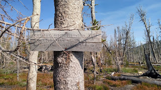
The trailhead
3 years later, much of the area is still charred grey and black and lifeless
The climb to the trailhead is pretty long, so it's common to do a partial shuttle and not even go all the way to the top of carlton ridge. Just the mill creek trail back down to the highway is a really fun ride and involves very little uphill pedaling. However, having been all the way up to carlton ridge a couple times I've found it to be worth the effort. It is pretty far up there, the ridge being an elevation of 8300ft, making for about a 5k foot climb from the bottom. But then 5k back down, nearly all the way to highway 12 on singletrack. you probably want a squishy bike as it's a little rougher than most of the missoula trails.
Normally, just driving out there and riding carlton ridge and mill creek is a big ride and more than enough for the day. But I did this during the move MT challenge, so just that didn't quite cut it. Instead of driving I rode from home, but also I had a secondary goal for the day- climb to blue mountain from the hwy 12 side. I had a track, and a general idea of how long it would take, and gave myself a cutoff time for when I needed to be at the bottom of mill creek. It seemed like I was ok, so after a water and snack break at the travelers rest store I went back up the highway instead of back down to lolo and the bike path.
Just climbing up to the top of blue mountain is another big ride in itself, and going the back way is longer and a lot less straightforward than just going up blue mountain road. There isn't really a direct route, and I'd never done it before, and was relying on a gps track i created myself in caltopo by drawing a line that seemed to go through on satellite imagery. It, uh, doesn't if you only have a forest service topo.
I hope this is right. Gee, I still have a long way to go. If you look closely you can see the blue mountain fire lookout up there
Eventually I came to a road with signs of use, and followed that to woodman saddle, which is just off the back of blue mountain. Then a bit of moto trail got me to the top
Where I was
Then it was a fast, fun descent down deadman's ridge and then straight to the dram shop for a beer.
This one's a pretty big day so make sure you bring snacks. I wound up with something like 70mi and 9000ft of climbing.


